
Index:
UPDATED ✅ Do you want to know the tricks to get the most out of Google Maps? ⭐ ENTER HERE ⭐ and find out what they are ✅ EASY and FAST ✅
Google Maps has become one of the best tools launched by Google and which allows users to be guided when undertake a journey or want to know the route to get somewhere.
In the same way, this function Google has been improving over time, that’s how have increased their elements offering a greater number of available features. He started out as a Map which you can access anywhere on the planet, and has become a app very complete that allows see in detail the desired routes.
Thanks to all these functions, this tool has become essential for most people, since it allows you to travel comfortably and safely if you don’t know the route to your destination. In addition, it has a large number of tricks which we teach you below so you can get him out the maximum benefit possible.
List of the best 40 mind-blowing tricks to get the most out of Google Maps
Google Maps has become one of the most important applications in recent years. It is used practically all over the world thanks to its excellent functions to allow users to know different routes either using it from your computer or mobile device.
Taking into account the importance of this application, here we are going to teach you top 40 tricks so you can start get the most out of it at all times and you can become quite an expert.
For it, follow each of the tips that we will teach you below:
Make your own maps
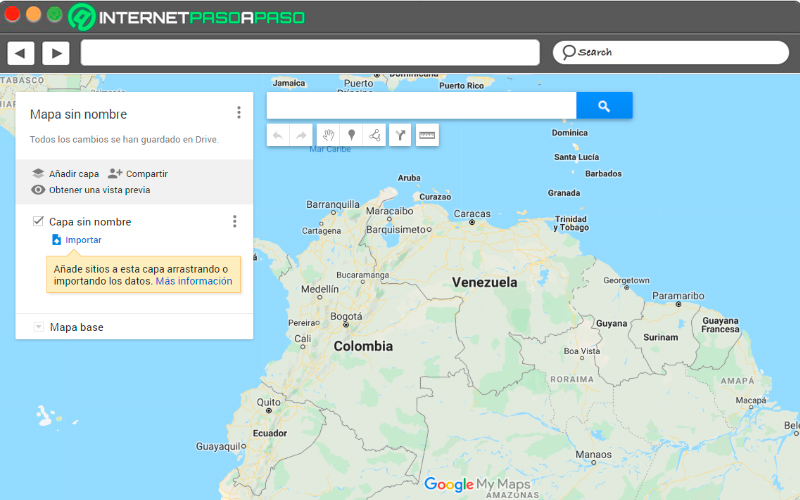
As we already know, this tool offers a lot of information which is impressive. However, this does not guarantee that we can find everything here and the application itself knows it. That is why it is allowed that the same users can draw your own destination maps. For example, you can create a map where you identify the destination places you want to travel tothis will prevent you from getting lost on your journey.
To be able to carry out this trick you simply have to click on the icon the three bars located in the upper left corner of your screen. There you must select the section “Your sites” and then “Maps”. Here you will find the option to “Create map”. Once you have reached this point you only have to select a specific area where all the information needed.
Now you just have to select the route you want to show and you can even measure the distance between one point and another. You can also add extra data and customize your design at your convenience.
Start controlling the music in your projects
This tool has a function that is mainly intended for when the user travels by car. In this case it is activate Google Maps for the tourthere will appear a bubble on the screen to the music option connected with the application that we select. Keep in mind that this will only work if you previously activate the following option.
The first thing will be to touch the drop-down menu, then we look for the section of “Settings”, there we click on the “Navigation settings” and finally we select “Show media playback controls”. When we enter this section, we must activate the option with the favorite application that we have on the mobile. In this way the bubble starts working while you are traveling in the car.
make a suggestion
It is very likely that on many occasions while you are using this google site, have you met someone system errorit may be that a store or the name of a street, avenue with a name other than the correct one, among many other errors that can occur.
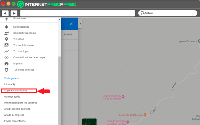
In case you realize something like that, you can make a suggestion editing to the system, taking into account that this it’s not a perfect place and less when they handle so much information worldwide. Therefore, every time you come across an error, you can make a suggestion to the system. To do this, go to the menu and look for the option “Tips and tricks”, there, fill in the corresponding fields.
Get a 3D view
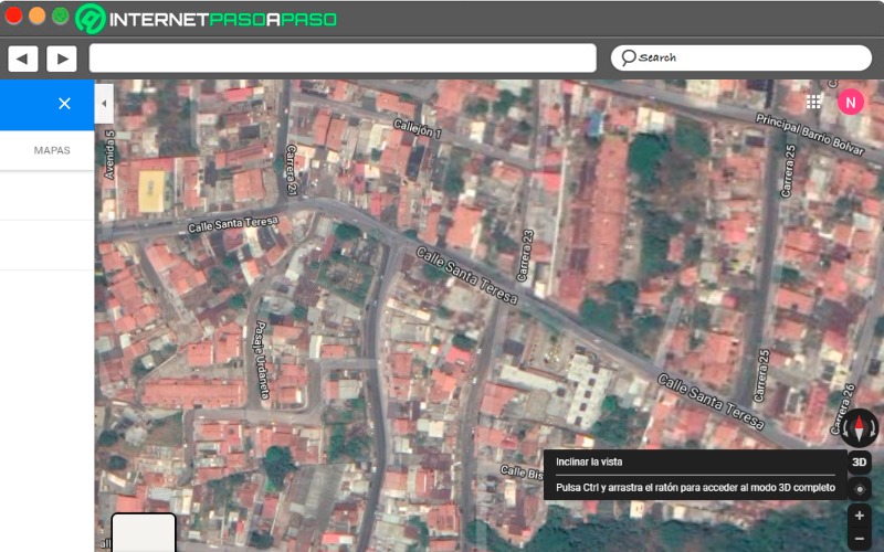
Another advantage that we can find when we use this site is that it generally offers two views by defaultthe first of hers that we always see when we enter your system is the map viewbut also has a 3D satellite view. This will allow you to have a more detailed view of a specific place.
that way you can tilt your eyes and move through the different streets of a city. A very attractive and entertaining option. To activate this function look for a location on the map and select the satellite view. Different options appear in the column that appears on the right side of your screen, here select 3D. Here you will enter this mode, hold down the “Control” button while you scroll on the map to change the angle and tilt of the view.
In the event that you are using it from your mobile device, you can also do something very similar. In this case select the part of the map you want to zoom in on and zoom in with two fingers until you can get a 3D effect. in this way to be able to recognize some shopping malls, buildings, among others. Please note that this does not work in all cities.
Travel back in time in Street View
This function is one of the most interesting for most users. However, it is still unknown to many. it is an excellent alternative for explore places in some cities before traveling to them. This will make it easier for you to do a kind of study prior to the area to visitwhich will help you recognize the streets, squaresamong other special sites.
Every time you use this method and visit some points of any country in the world, a small clock icon in the upper left corner of your screen. Click on it and you can start to find out about the most important places in the cityas well as each of the important events that have happened there.
get your car
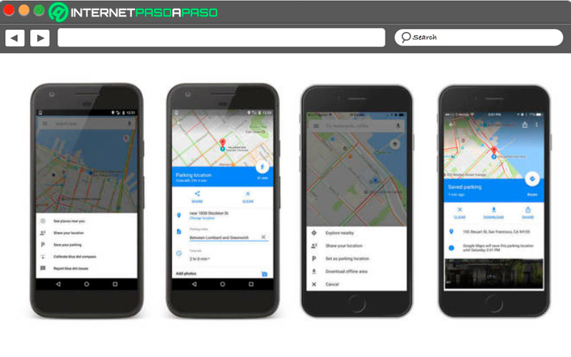
If you are one of those people who constantly forgets everything, how far you have left the parked carthen you can start using this tool as a solution for find your car and not have more scares. Note that this procedure changes a bit for both Android and iOS devices.
In case you are a android userand you have parked somewhere, you can click on the location point where you are and select the option “Save parking”. This location will be added to a new label that will allow you remember that placeyou can also add more information to said label as a kind of reminder.
Now if you’re a iPhone user you must also select the blue location dot. Here a new window will open where you have to select the option “Set as parking location”, after this you will see an icon with a “P” where you can enter and see where you left the car parked.
Change the arrow for a car
Everytime that the navigation function inside the map is activatedon the screen we will appear represented by a blue colored arrow. But keep in mind that this is fully customizable, so you can exchange it for a car. However, it is important to clarify that this option is only available for iOS users Until now.
Therefore, to activate this option you have to touch the blue arrow that appears on the screen, the system will automatically start change navigation mode to driving mode and the possibility of select a car to represent the famous blue Arrow. They will appear there different car models to selectchoose the one you like the most.
Check the air quality of a city
Conservation of the environment is one of the most important factors today, especially the quality of the air which directly interferes with the health of the human being. Due to this, this application has implemented in its system the possibility of knowing air quality data in some cities.
For Google to be able to offer this had to partner with the intelligent environmental firm Aclima, This allowed them to develop a pilot program capable of measuring the air with some cars that have been previously equipped with google street view teams and that they are able to offer this data to the web.
Thanks to all this project, now users can be constantly checking this environmental factor. In addition, this data produced by the system can be used to various ends, Either for create environmental conservation plansshare information in various mediadevelop new models for improve air qualityamong many other alternatives.
Use it in an easier way
Usually this app is mostly used when we are traveling or riding in the car and we want to know the location of a specific place. Therefore, being able to use the app can be a bit complicated. For this, this application incorporates in its system some tricks That will make its use much easier.
in the case you want zoom in with one hand, you can double tap on the screen, but when you do the second touch slides your finger up or down instead of lifting it.
For map rotation, you can do it with only two fingersin this case both you move them to the same side as tracing a semicircle. in case you want return to normal viewclick on compass icon that will appear in the upper corner of your screen.
Now if what you want is to activate the function in 3D to have one better vision in the map, touch the screen with two fingers, and slide your fingers to the top of the screen. Automatically 3D view will be activated.
Don’t miss the last train
This trick is ideal for those people who are always late somewhere, either for your work, a personal appointment or for the service station. Therefore, if it has already happened to you the train leaves you thrown out for being late, you can start using this site as a reference for prevent public transport from dropping you off again.
In order to use this function you have to write the name of the destination and click on the train icon, Then an option will appear that says “Departure”, then select the option “latest” to provide you with the necessary information to ensure that it does not leave you in its path. You also have the opportunity to post a reminder in case you forget.
Check your travel history
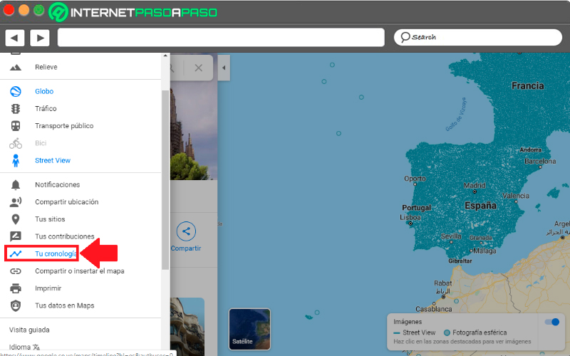
Keep in mind that every time you use this tool and leave a record saved, they go to be stored in history. Note that this will only be visible to you, allowing you to remember or know what trips you have made during the year or what route you have made. It also gives you the ability to see which addresses you have set as home and workamong other elements.
To access the history and remember what trips you have made and what places you have visited, you have to click on the three bars of the menu located at the top left of your screen. There select the section “Your Timeline” later the information will be shown to you in a new tab. In the event that you do not want to have that data there, you simply have to delete it.
Organize trips with the help of Google Maps
Mostly when organizing a trip with the group of friends It is very difficult to reach an agreement together, this can create discussions and even a possible cancellation of the trip due to not they manage to agree. In this case, the app helps you make all this much easier.
This is how she will handle organize your route or possible routes so that everyone can see and vote for each one of them, offering several alternatives.
To start this process you need to add locations and select a list of your favourites. These options can be passed to a list, which you can share for some reason. social network, text message, email among other options. The recipients will be able to see them and vote for the one they like the most. The most voted will be the winner for your next trip.
Use it out of town
As we already know this app has not been created for just drive within each city, but on the contrary, it is designed for those people who have the soul of adventurers and want to travel the world. Therefore, this site has become the right hand of all these people to Time to start your adventures.
In this way, here you can find a great number of routesso much for Spain as for any other country in the world. In the event that you want to travel to another country that you do not know, you can easily make use of this program to be able to locate yourself and move from one place to another without getting lost.
share your location from your smartphone
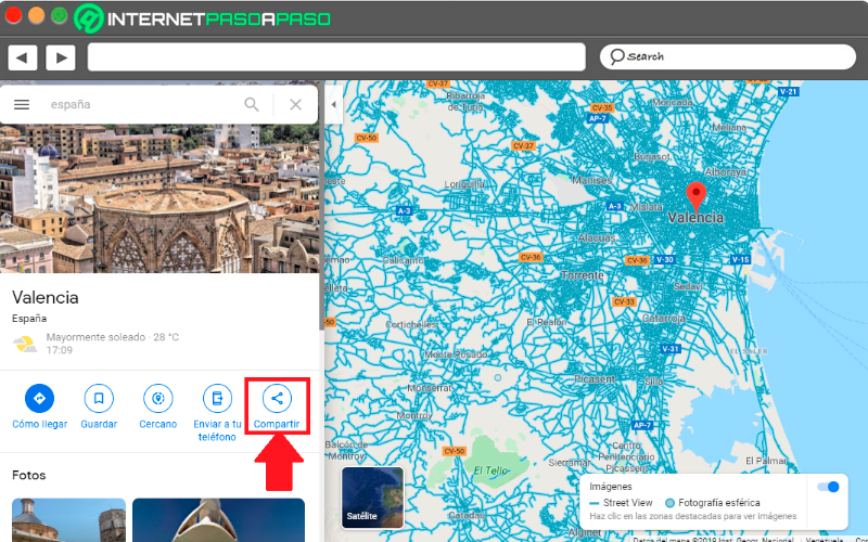
It can be said that this is a very used function today, since it allows provide your location to third parties in a very simple and fast way. Ideal for when the other person he doesn’t know the city and he wants to meet you. In this case it is about sharing only one point on the map, be it your home address, a restaurant where you are, your work office, among others.
Therefore, to share this you simply have to enter the map and click on the place where you are, there you will see a menu where you will find the option to “Share”, the next thing will be select application and contact where you want to share that location.
Share your location in real time with another person
This tool also gives you the possibility to share your location in real time with other people for a few minutes, this mainly helps you to know where he is a family member or your children at a certain time. This is done through a link that is sent to the person you want, who can make you a minute by minute trackingthis monitoring will last as long as you want.
For this you must share your location as we explained in the previous point. At the top of your screen you will find an option that says how long to share your location, and under this you select who send you that link. Keep in mind that this person can see minute by minute what places you are traveling to.
Access Street View from your smartphone
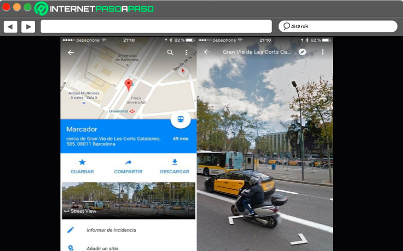
This option is also available in the app. mobile devices, but it is not visible to the naked eye, so many users are unaware of it. It gives you the possibility of view 360 degree photos from different cities around the world, ideal for when you are traveling to a place for the first time and need several places as reference points.
To be able to find this element in your terminal you must leave your finger pressed on the location you want access street view, until you get a marker. When this marker appears on the screen Google will send you to one location sheet, There touch the address that appears at the bottom of the mobile screen and in the tab select the option “Streetview” that appears on the photo. This way you can start using this tool from the terminal.
Find out which businesses are close to your home or location
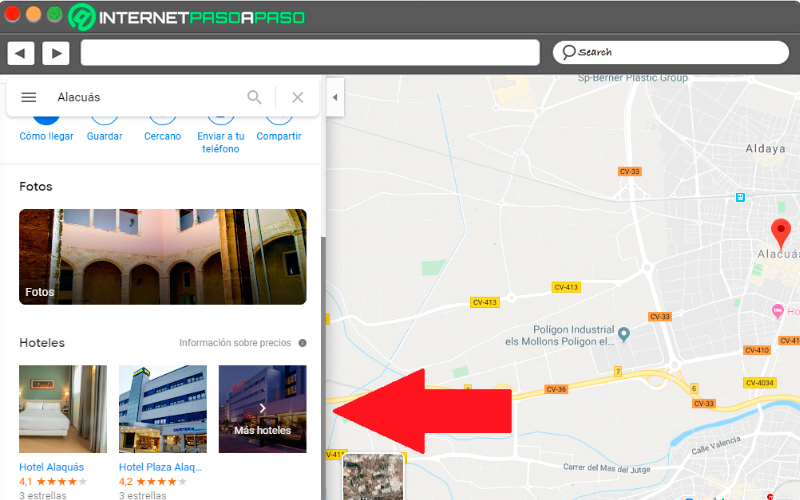
One of the great benefits that we can get from this tool is to find out what commercial places are close to our locationideal for when we arrive new to a place or we are simply traveling and do not know the place. And it is that one of the main functions of this application is that it offers you a map system where you can know what streets, avenues and shops are nearby.
Therefore, if you have arrived at an unknown place and want to go shopping somewhere nearby, you can search for it in the following way: first will locate your location on the map, now press on the icon that was created on it and in the sidebar you will find different shortcuts where will appear businesses that are nearby, such as restaurants, supermarkets, hotels, among others.
Learn to measure the distance between two or more points
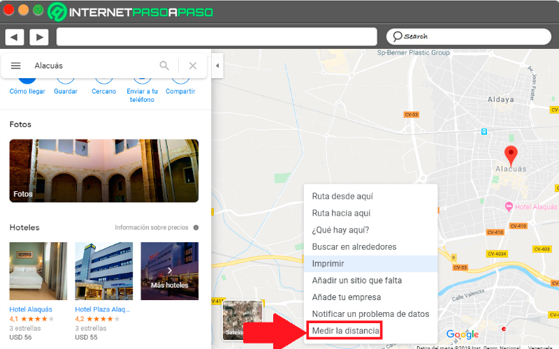
When we are going to travel from one place to another, the first thing we ask ourselves is the travel time. So if we have this concern Google Maps You will not be able to answer it in a very simple and fast way, since it allows measure the approximate distance it can take from one place to another.
In this case, the first thing to do is right-click on the starting point of the route you want to calculate. In the pop-up menu you will find the option to “measure distance” and then click on the destination point. In this way the system throws you a Approximate duration time between point A and point B.
Download maps to your mobile to see them offline
It can be said that this is one of the most useful features of the application, as it allows its users to be able to download the maps that they need and that way to be able to see them No internet connection. Ideal for when you are traveling and have poor signal or internet. Can realize downloading these maps It is very simple and easy to do.
In this case you have to locate the point that interests you in the application, there you will touch the bottom bar of the screen where the name of the place you searched for appears. Now a new window appears where you are going to click on the option “Discharge”. here you can download area of up to 120,000 square kilometers with a maximum weight of 500MB.
Another way to download these files is to do it without having to choose a specific point. To do this, click on the three lines located in the upper left. Then choose the option “Offline Maps”, the ones you have downloaded will appear there, to be able to select a new one, press in or out of the screen with your fingers until get location you want, and finally select “Discharge”.
Some places have indoor maps
As if that were not enough, it is not enough with all cartography that this site already offers us, but also has maps inside some special placesbe it some museums, shopping malls, stations, sports facilities, among many other important sites in the world. This will allow you to get a better perspective of some specific sites.
This function has been around for a long time but little by little it has been improving and expanding. Please note that this function is only available in some countries, especially in the European continent and the United States. You can also contact directly with the support center in case you want provide your own place plans that you want to post here.
Check out upcoming concert halls and plays
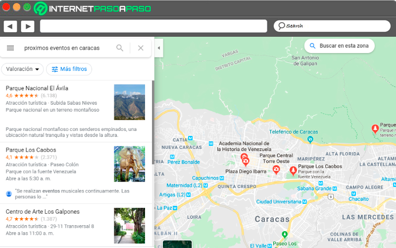
As we have already mentioned, this site is responsible for keep users informed of the departure time of the train, which restaurants or shops are nearby and their opening hours, among many other functions. It is also important to mention that there is another key element to highlight and it is that it also gives you the possibility of knowing when they are upcoming plays and concert halls in your city.
You can find this through search boxthere you write upcoming events in your city and you will automatically be told which ones are available for the next few days.
Indicate the stops you will make on a trip
There is nothing better than a planned and well organized trip. Therefore, if you are one of those people who likes to keep everything in order and make some stops while traveling, you can use the help of Google Maps for it. If someone has recommended that you eat somewhere restaurant or that you visit some tourist site during your tour and you do not know how to get there, you can use this application to be able to reach them without problems.
In case you want to add some stops along your routeyou must click on the icon the three points located to the right of localities. There you will see a popup menu and in it select the section of “Add stops”. Finally another window will appear where you must add the new addressthat is, the stops you want to make.
Enter and exit with a single touch
when we use the maps mobile app It is very possible that we find ourselves driving or somewhat busy, which makes handling it with two hands a bit complicated. Usually for entering and closing some location is done with Pinch-to-zoombut when we only have one free hand this is not so easy.
Luckily for most users there is another way to do this and it only requires one hand. In this case you have to double tap the smartphone screen and then keep it pressed in the place we want to locate, then with the help of two fingers zoom in or zoom out the screen according to the comfort of each one.
Use Google Maps Go
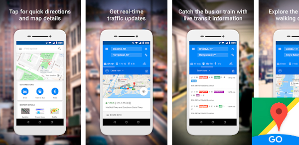
In case you are using a mobile device little powerful or it is a little old model, then you can use this version which is a little lighter and will surely run much better on your computer. It is available in the official Android store.
Note that this does not have the same design than the original appbut it will work for you correctly and will help you get to your desired routes in a simple and fast way.
Use voice commands
If you mobile device is an Android and has the mobile application, then you can start using it through voice commands, this tool is very useful when you are driving or doing some other activity. Therefore, through voice commands you can start giving directions to the app. In this case you have to say “Ok Google” and you must have GPS mode activated if you are driving.
In this case it will open the voice function of Maps Y not google assistant. In case you get complicated name the command, then just click on the microphone that appears on the screen. Here you can ask different things, like How long does it take to get to the destination? What is the nearest gas station? Among many other questions.
Find ski routes
Another of the great alternatives that this site offers its users, and especially ski lovers, is that provides them with at least 100 different ski routes around the worldeither in Canada, the United States, among other countries. This will allow them to know which one to go to and start plan your next trips.
Modify addresses with the help of your mouse
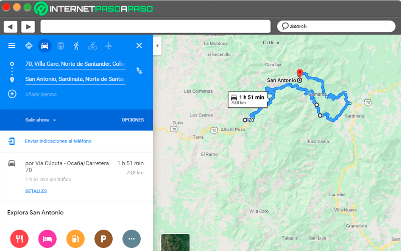
Many times Google Maps It can provide us with some routes that may not be the best or the shortest, or you simply want to avoid going through a specific place. In this case you have to grab the cursor and drag it to a new way you wantnote that this will work if you have it with the instructions for car, walk, or ride a bike. For public transport these routes cannot be modified.
You can let other people drive your ride
To begin with, it is important to clarify that this option is not enabled in all countries, in the case of Latin America tends to be used very little compared to Europe or the United States. This is about what they are the shared transportation serviceswhich has become the modern transportation. Thus, Google has added to its system the option of travel from companies such as Lyft and Uber in your mobile app.
In this case you just have to enter your destination and then click on the icon with a figure of taxi or public transport. You will then see options for carpool With Approximate rates and time. Previously they could request Uber or Lyft directly from this appbut was removed without any explanation.
Find more accessible routes
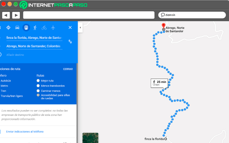
In the case of people with mobility problems, they can look for the most accessible routes for wheelchair users. In this case you should tap on “Indications”, you write the desired destination and select the icon of the public transport. After this, tap on the button “Options” and the section of “Routes”, at this point you will find the “Wheelchair Access”, as a new quieter route with less traffic.
In general, when this option is chosen, the program gives you a large number of routes so that you can select the most convenient one. This function began mainly in London, after in New Yorkcontinued on Mexico Cityand thus it has been expanding little by little throughout the world.
Learn what the Street View commands are
As we already know in the world of street view we can find a large number of elements that will help us achieve a better result. However, in order to get the most out of it it is necessary to know the commands that will allow us to use it only with the keyboard.
Therefore, here we present each of them:
- +/- = Zoom in / Zoom out.
- left arrow / right arrow = turn left / turn right.
- up arrow/ down arrow = Move forward / move backward.
- w/o = Move forward / move backward.
- A/D = Turn left / Turn right.
Search nearby
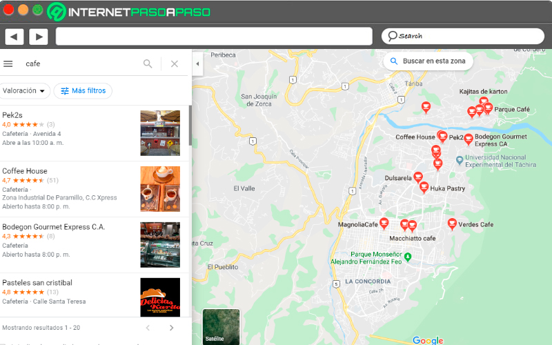
On many occasions we want visit a shop, a cafe, a supermarket or any other site, but first we want to know your specific location. In this case it is important that we tell the application what is our location so that she can realize bliss search. Therefore, you should only indicate or write in the search box “Coffee” and it will automatically tell you all the nearby cafes.
This option is ideal for when you want andfind businesses near where you arewhether franchises like McDonald’sa supermarket, among others.
Become a traffic reporter
when you are using the desktop version of Google Mapsyou can configure the tool to teach you the traffic of your city in real timethis is achieved by clicking on the link of “Traffic” which is located in the menu located in the upper left corner.
In the center of the menu you will find a section that shows you two options, either choose between “live traffic” or “typical traffic”, the latter allows you to see the traffic at a specific time, for this you choose the day and time. In the case of using the mobile app you can see live traffic.
Get to know the Sitch car park
As I have already mentioned above, Maps allows you to remember where you have parked your car, but this is not the only advantage it offers, it also gives you the possibility to know which parking lot you can use and which of them is the best. At least when you’re looking for a direction to get there you can use your location either from your iPhone or Android and thus find a parking lot.
To do this you must select the “P” icon at the bottom of the screen, there you select one of three designations, either “Limited”, “Medium”, Easy”, According to each of them, it will be the time that the system takes to assign a nearby parking lot.
Get the ATMs
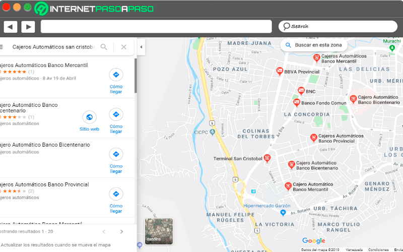
One of the main problems in most countries is cash, therefore, if you are in another city than yours and have stayed out of cash and you need to resort to a ATMbut you don’t know where they are located, then you can use this tool for it.
In this case you should write the search bar “ATMs Barcelona”, automatically the system will show you an image with all the ATMs available in the area you have indicated. In the case that you do it from the mobile and you have your location visible, simply place “ATMs”.
Leave a comment on the sites you visit
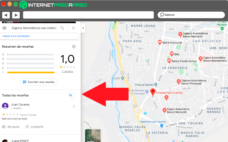
Every time we visit a site Google Maps we can see that these have a rating, this allows users to know how safe and reliable that place is. This is because people who have already visited that place or establishment have left a rating depending on how good or bad your experience was in that place.
Therefore, it is important that every time you visit somewhere leave a review and rating. To do this, you just have to click on the establishment you want to evaluate, either from the smartphone or computer. There, a new window will open with the qualifications of other people and the corresponding fields so that leave your note and upload a photo of the place if you wish.
Please note that these reviews are awarded by Google, it is so that over time and when you have several reviews made, you will be rewarded with more Google Drive cloud storage.
Tilt the smartphone to be able to guide you
Although it seems silly and that it cannot work, the reality is different, and that is that this method, despite being so simple, is very effective since this would allow Google Maps can be oriented to determine your locationsince it uses the data from your phone’s gyroscope.
Therefore, if you are traveling and have reached your destination, the first thing you should do is tilt the terminal in various directions so that the app can find your location quickly. When this has been detected, the point of blue location will show as with a shadowindicating that you already have the correct address.
interior directions
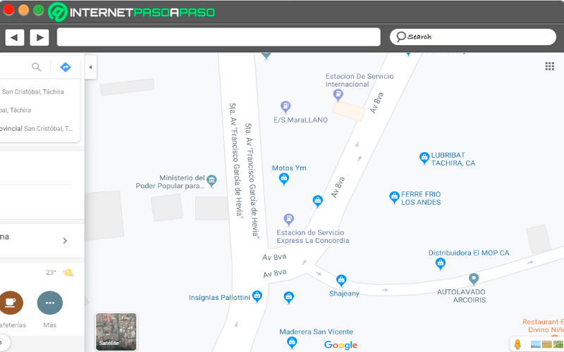
Every time a search is made for a place on the site, you are shown the main addresses of the area that you have previously selected. However, today there is what is the inner mapping and which will let you know which streets exist within that Location. Previously it was only available in the mobile versionbut now it can also be used from the computer.
The only thing you have to do is select the desired location and then approach little by little until they appear interior details. This will let you know street names more easilyand even find an address in an easier way.
Know which radars are on your destination route
Another of the alternatives that we can find on this site is that it allows us to know or know what radars are located on the route where you are going to travel. Therefore, in order to visualizing all these radars is very simplesimply select the destination where you want to go and then zoom in on the map to get closer to the route.
These radars will be shown on the road if there is one, they are determined with color codes and if you click on them you will be able to know for how long the presence was detected.
What does the little person in the bottom corner mean?
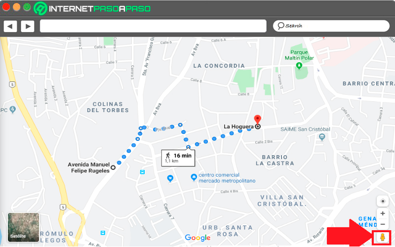
Every time we enter the site we can see a yellow person located in the lower left part of the screen, known as “Peg Man” either “The little orange man”. In this case you can pick up a little man and place him on any map location and it will automatically be sent to the view of that street.
when you find yourself in street view modethis will guide you with your eyes current of the map window in the lower left corner.
Hide your location data
You may not always want your location data appearssince this will cause your privacy is not 100%. So you can set the privacy controls and in this way Periodically clear the location history of the site’s servers.
You can configure this type of information so that automatically deleted every three months, 18 months or kept until you delete them manually. Note that there are other ways to erase all this information, but are much more complex. Therefore, in this way you can easily and quickly erase your location.
Use the augmented reality of the application
This has become one of the most recent and useful functions that this system at your service. It can be used from mobile apps so much for iPhone and Androidwhere users can get a augmented reality that will allow them to position themselves better and not have problems with The ubication. Ideal for when traveling to a city that we do not know.
Please note that this feature is currently only available for when walking tours, This will allow the entire environment where we walk to be analyzed. Once the walking tour begins, the start button will appear. “Augmented reality”, When you press it, it will begin to analyze the environment to offer the correct path and a very precise location.
Applications